
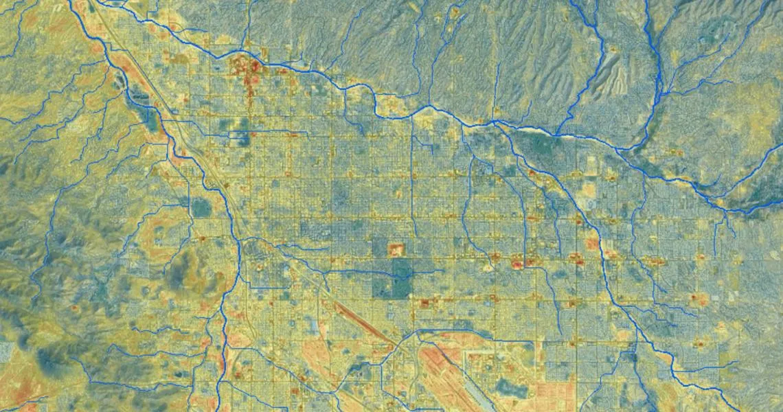
Urban heat island in the Tucson region as shown by Pima Association of Govt.'s Infrastructure Prioritization Tool
Lead CCASS Contact: Ladd Keith
Full project title: Evaluating the Use of Urban Heat Island and Heat Increase Modeling in Land Use and Planning Decision-Making
Description: The impacts of the urban heat island (UHI) are well documented, including increases in heat-related public health issues, stresses on urban ecology, and energy usage to mitigate the higher temperatures. UHI is of particular concern to cities in the Southwest, since it counteracts the cooling that otherwise normally occurs at night. While UHI mapping and modeling has become more sophisticated in recent years, there is still an information gap between the heat maps and models, urban planning and design strategies to decrease heat, and the use of that information in policy decision making. This study focuses on documenting the current use of urban heat maps and models in communities in Arizona and New Mexico and evaluating best practices and opportunities to increase their usability.
Research Objectives:
- To document how communities in Arizona and New Mexico are currently utilizing urban heat maps and models,
- To work iteratively with several pilot communities to examine the challenges and opportunities in utilizing urban heat maps and models in day-to-day land use planning,
- To expand our network of community partners interested in future collaborative efforts.
Funding: CLIMAS