
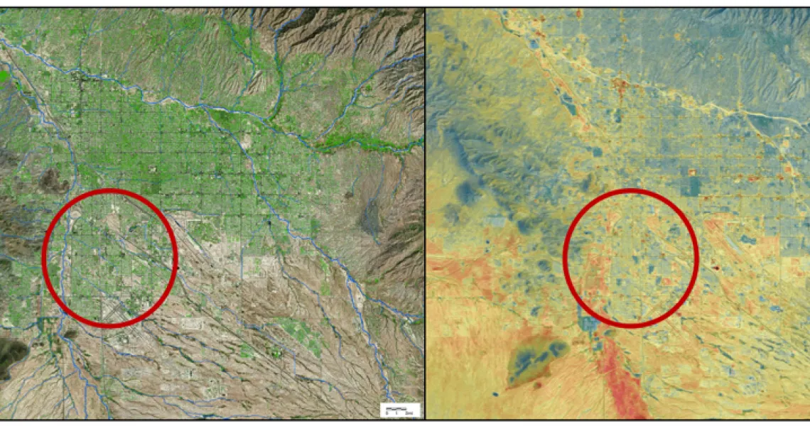
Red circle focuses on south side of Tucson. Left map: Tree canopy cover (green) is disproportionately low in this area; Right: regional surface temperatures are comparatively higher (reds and browns). Maps from Pima Association of Governments.
Lead CCASS Contact: Andrea Gerlak
Green infrastructure (or GI, i.e., spaces with permeable surfaces dominated by vegetation) is not always available or accessible to residents of low-income communities. This community-university-partnership works to address this inequity in Tucson, Arizona, helping to engage community members in planning and development of a greenway using federal funds. This road is a designated bike route that links residents to multiple amenities including a library, a transit station, numerous parks, and more than a dozen schools. It is expected to serve residents not only as a safe route to schools and amenities, but also as GI that would decrease floods and extreme heat.
The project aims to build capacity, social capital, and communication between community members, city officials, neighborhood leaders, university scientists, and local NGOs.